Katahdin

Katahdin
Aug 17 2010 - End of Part 1

Tuesday, September 14, 2010

Sat. 11 Sep - Neels Gap

We woke up to rain at dawn but by the time we packed up it had stopped. Warm and humid all day with thunderstorms in the afternoon.

It was good hiking - like being back in Virginia. There were large thickets of Mountain Laurel and Rhododendron. The trails are "normal" and they use switchbacks. I like Georgia so far.

Wendy began having some knee problems today. She thought she was going to have to stop but she pushed through.

We planned another 15 mile day (to Neels Gap) but decided to get to a shelter when a thunderstorm came up in the afternoon. Lightening struck about 100-200 away. It rained hard (about 2 inches I learned later) and we were quite wet.

We went to the shelter (Woods Hole) and the water source was dry. We are soaking wet and there is nothing to drink. The ground soaked it up like a sponge. We continued up Blood Mountain planning to stay at the shelter on top. On the way up there is a campsite but once there, it was the same story, no water in the spring. So we continued up the mountain, took a few pictures and then went down Neels Gap as planned. Very tired.

It was almost dark when we arrived so I have no pictures. I will get some pictures in the morning and save the story for tomorrow.


Fri. 10 Sep - Gooch Mountain Shelter


A few raindrops this morning, warm and humid, low 80s.

Back on the trail today! Thanks to Greg for three weeks of us staying at his house. It was nice and nice to see Isis (our dog). Also, we heard from Andi - she made it and is in the house with the graduate research assistant and his family.

We left the motel at 7:00 this am and drove seven miles east of Hiawassee to Sally Smith's house. She lives about three miles from the AT. We left our car there and she drove us about 60 miles south to near Springer Mountain. FS42 crosses the AT .9 miles north of the trail terminus. Starting at 9:30, we hiked south the 0.9 miles just to make it official (i.e. mile zero of the AT going north).

We took some pictures then started part two of our hike. With the hiking south plus a couple of side trips, we did over 16.5 miles today. Did not arrive until after 8:00. Very tired and sore (hips and knees).

There are two girls here (Meadowlark and Littlefoot) who started hiking 29 days ago from North Carolina. Tomorrow night in Springer Mountain Shelter is the last night of their trip.

Feels good to be back on the trail.

Sunday, September 12, 2010

Trail journal update

Just a short note to say we are OK and have completed 42 miles.

Signal has been poor. I will send the daily updates with pictures when I get a stronger signal or when back in town.

Thursday, September 9, 2010

09 Sep - Georgia

We left Greg's this morning and drove to Hiawassee, Georgia. Tomorrow we go 68 miles south to Springer Mt. and hike back here (5 days). Then we repeat and drive north 68 miles to NC and hike back.

That is as far as I have planned. Can't believe how little I have prepared. Hope it is not false confidence. Pictures tomorrow.

Monday, September 6, 2010

Weight loss

Below is the record of my weight loss while hiking:

258 lbs - 2009 Mar Before leaving for Hong Kong (all time high)
228 lbs - 2009 Dec Return from Hong Kong
235 lbs - 2010 Mar

233 lbs - Apr 02 First day of hike
218 lbs - Apr 16 Duncannon, PA, Doyle Hotel
213 lbs - May 04 Palmerton/Slatington, PA, Stemple house
208 lbs - May 13 Unionville, NY (Esther's scale)
197 lbs - Jun 17 Manchester Center, VT, Sutton's Place
189 lbs - Jun 23 Killington, Vermont, Inn at Long Trail
187 lbs - Jul 02 Glencliff, NH, Hikers Welcome Hostel
192 lbs - Jul 04 Franconia Notch, NH, Chet's (One Step AT a Time)
188 lbs - Jul 21 Andover, ME, Pine Ellis Lodge
186 lbs - Aug 17 Millinocket, ME, Katahdin Inn (Esther's scale)

192 lbs - Sep 06 Greg's house (after 3 weeks off trail)


For the record, Wendy lost 10 lbs in weight but more than 10 lbs in inches.

I lost 25 lbs while in Hong Kong then gained some back. Then I lost 45-50 lbs while hiking. It is starting to come back so it must be time to start hiking again.


Sunday, September 5, 2010

Back to the trail soon.

On Saturday, we dropped off the rental car and took Andi to the airport. Her plane has made it to Paris and she should have connected to Madagascar. She may have gone to a hotel depending upon the time. She has to be back at the airport at 4:30 AM which was only about 6 hours later if the plane was on time. We do not expect to hear from her until she arrives in Maroantsetra which will not be until overnight tonight. The earliest will be when we get up tomorrow.

My plan was to leave for Georgia on Tuesday but we need to take care of car issues and banking issues so maybe Wednesday. We will use Andi's car and get shuttles. I still need to make those plans. We will see how well this type of hiking works. It will be nice to periodically have access to a car but keeping it available up the trail via shuttle could be more trouble than it is worth. We will see....

I will update again before we leave.

Wednesday, August 18, 2010

18 Aug - Upstate New York

Last night after dinner, we said goodbye to Flatlander. He started his trip home. Tonight he should be in Unionville, NY, having a celebration dinner at the Mayor's house. (The Mayor's house is a hiker hostel owned by the former mayor of Unionville).

This morning we said goodbye to Capt. Bly. He is heading to pick up his wife today and start the long trip back to the Houston area.

We left with Esther for her house on a lake in upstate NY. We have finished dinner and I am about to work on plans to get back to VA. We need to get Andi ready for her trip to Madagascar. Then we will make a decision about hiking the rest of the trail this year.

I will post again when we have a decision.....

17 Aug - the hike down

The AT goes up the Hunt Trail. We chose to go down a different way -the Saddle Trail and Chimney Pond Trail to Roaring Springs Campground where Esther met us. 

It was supposed to be easier and probably was. But it was not easy.  Chimney Pond was beautiful and view of the other side of Katahdin was spectacular.

The last day ended with a final moose sighting. It was a mother and calf. This time I was close enough to get a picture, even with a phone cam.

We had a final dinner at the AT Cafe including the Summit Sundae that we all shared.

17 Aug - at the summit of Katahdin

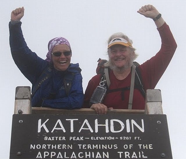
Suddenly, out of the fog, was a small crowd of people and we were there.  The summit sign.  End of the trail.

We saw some folks we knew: Appy and Pappy, Pi, Poppins, and others. 
It was windy and cold!  We ate but were not comfortable.  I had on three layers of clothes.  

We stayed about 45 minutes taking pictures and talking to other hikers.  We hoped it would clear but it did not.

17 Aug - Climb up Katahdin, part 2

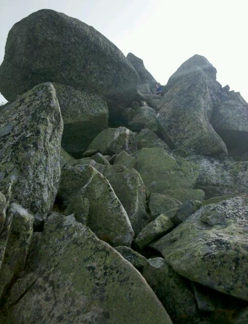
The higher we went, the colder it became. Sometimes we were on the clouds and fog but sometimes we got brief but spectacular views.

The climb became a lot more difficult until we reached the tablelands.

17 Aug - Climb up Katahdin


The weather forecast was good when we started the climb but it was still
cloudy with a little misting rain. We were hopeful.

Katahdin Falls was beautiful and the initial climb up was not too difficult.

Tuesday, August 17, 2010

17 Aug - Baxter Peak, Mt. Katahdin


We made it to the top!

We are back down and have been to dinner at the AT Cafe again. I will update the journal with more pictures tomorrow. We are traveling to New York tomorrow so not sure when.

Monday, August 16, 2010

16 Aug - Rain day

As predicted it rained so we stayed in Millinocket. Spent a lot of time at the AT Cafe. Fortunately the food is good because we were there for breakfast, lunch, and dinner.

Tomorrow the forcast is better and we plan to summit Katahdin. There seem to be a lot of people we know who have caught up to us so there will be friends climbing with us. I will send a picture when I can.

Sunday, August 15, 2010

15 Aug - The Birches (near Katahdin Stream Campground)


More great hiking weather. Mid 70s. Unfortunately the forecast is for rain tomorrow.

Immediately after leaving this morning, we crossed into Baxter State Park. We followed the Penobscot River and then the Nesowadnehunk River, a tributary. There were some beautiful rapids and waterfalls. In all, we hiked only about 10 miles and arrived at Katahdin Stream Campground before 1:00.

Instead of trying to make reservations in The Birches (special campground for up to 12 thru-hikers), we met Wendy's Aunt Esther who drove us into Millinocket for the night and will drive us back to the trail for the final climb.

While waiting, we saw POW and TLC who had just returned from their climb of Katahdin. They were tired and elated. This completes their hike of the AT that they started 3 years ago. We made plans to see them later at the AT Cafe.

The Birches is next to Katahdin Stream Campground and where most thru-hikers start their climb. From there, it is only 5.2 miles along the Hunt Trail but it climbs 4150 vertical feet to the summit of Baxter Peak at 5,268 feet. It normally takes 9 hours hiking time to complete the 10.4 mile round trip.

We are going to get up at 4:30 and check the weather. Rain is likely with a chance of thunderstorms. If so, we will postpone for a day.


5.2 miles to go. . . .

Pictures for 14 Aug