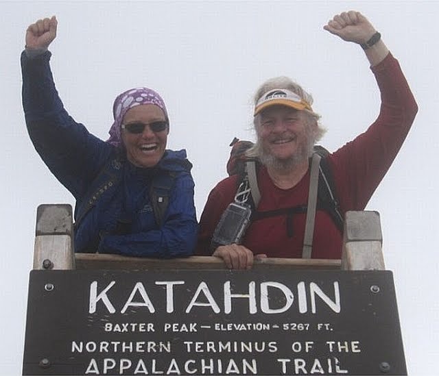
Katahdin

Katahdin
Aug 17 2010 - End of Part 1
Showing posts with label Hiking - Georgia. Show all posts

Tuesday, September 14, 2010

Wed 15 Sep - zero day in Hiawassee

Warm and humid but we have air conditioning, a pool and a hot tub so who cares. We are soaking ourselves in alternating hot and cold to relieve the aches and pains. Knees, hips, and blisters are all improving. We have been to the "all you can eat" buffet at Daniels Steak House twice.

We also have done a resupply from items in our car and from the Rite Aide down the road. Having a car is still strange but I have tentative plans for shuttles that will get us through GA, lower NC, and the Smokies.

Tomorrow, we will leave our car at Sally Smith's house again and she will take us to Nantahala Outdoor Center (Wesser NC) and we will hike south 68 miles over five days to get back to Hiawassee and our car. We will then try to repeat this cycle with a couple who live just south of the Smokies.

Becky had asked what our plans were and how many miles we have left. Here is an explanation.

We left in April with three possible goals:

1) Hike to Mt. Katahdin in Maine
2) Complete the AT
3) Thru-hike the AT in 2010

We have decided that we do not have the time or desire to repeat this year the 300 miles we already hiked in 2007 and 2008 from Harper's Ferry to the Daleville/Troutville area of Virginia (near Roanoke). So goal 3 is out.

We decided that we do want to complete the AT this year so we have started hiking the remaining miles from the southern terminus at Springer Mountain in Georgia back up to Daleville/Troutville. This is 719 miles and it will complete the AT for us (if you include the miles hiked in previous years).

Wendy starts a job the beginning of November so we only have 6 weeks remaining. We probably will not be able to complete all of the 719 miles by end of Oct. but we will do as many as we can. There are 460 miles from Springer Mountain to the Virginia state line (includes GA, NC, Smokies, TN). It will be another 260 miles in Virginia to get back to Daleville/Troutville . Even if we go slow, this will put us well into Virginia and we will then finish the remaining miles on long weekends (she only works a 3 day week and I still do not have a job).

Phone signals have been weak and sporadic so I have not been able to update regularly. I will still try to write each day and send when I can.

My impression of Georgia is still good but I have never seen so much poison ivy. The trails have been good and the shelters have too.

Also an update on our daughter Andi and her trip to Madagascar: we have spoken to her usingSkype on the cell phones (we call the graduate researcher's local cell phone). Her trip was difficult but she likes where she is staying. On Monday she and the researcher plus 3 locals and a local Wildlife Conservation Society employee left via boat to ride up a river to a village where they start a 13 trip on foot into the forest to install cameras. In the village, they will pick 21 local guides to act as porters to carry their equipment. She seems happy.

I have a couple of links that I should have passed on sooner.

This is a nice map of the AT. As you zoom in it shows more shelters. Should give a good view of the terrain and where we are sleeping when in a shelter.

Also here is an online (PDF) version of the Thru-hikers Companion. This is the book I use on the trail to plan our hikes, stops, breaks, etc.

I will put both links on the links page.

Tue 14 Sep - Dicks Creek Gap (US 76 Hiawassee)

Warmer and more humid today, highs in the mid to upper 80s.

We hiked 11 miles to Dicks Creek Gap where Sally Smith picked us up in her VW camper and took us to our car at her house. We drove to Hiawassee and are staying at the Holiday Inn again. The next 36 hours are for rest.

Wendy's knee problems continue to be bad but today they improved after about an hour and did not return. However, we both are very sore in general. I am having knee and hip problems continue but right now, the worst problem is blisters on my left foot.

We are taking a zero day tomorrow. There have been some questions asked that I will post answers tomorrow and describe what we are doing....


Mon 13 Sep - Tray Mountain Shelter

A cold night last night after the storms went through. I did not have enough clothes. But warmer today and more humidity. Highs in low 80s.

We hiked 15 miles again today. When we stopped for lunch at a shelter, we saw that Muncher signed the register so he did continue hiking and spent the night there. So he is ahead of us and we should see him again.

I feel that I am immediately back into the rhythm of hiking on the trail. I was worried that it would be difficult to go back after such a long rest. It is clear that we have lost our hiking legs but I feel the strength returning. We have done good miles and much more that when we started in April. I think we can do even more. I like the trail here and the shelters have all been very nice.

We had a three mile climb at the end of the day that was hard going. When we arrived at Tray Mountain shelter, we met Flipper (thru-hiked in '96) who offered Wendy some coffee. He brought it to us and we talked for a while. He is out for over 3 weeks and just taking his time going from shelter to shelter and "enjoying the trail". He plans another thru-hike at some time in the future. He had killed a rattlesnake and eaten it - he showed us the skin. In addition, there were two snake skins in the shelter courtesy of Flipper. He said it keeps the mice away.


Sun. 12 Sep - Low Gap Shelter


It rained last night so it was nice to be indoors! Cooler and less humid after the storms. Good hiking, highs in upper 70s.

The pictures above were taken this morning before we left Neels Gap. The pictures show Mountain Crossings at Walasi-Yi, an outfitter, hostel, info center and tourist trap located in Neels Gap. The Appalachian Trail run right through the building (only place on the trail). It is a nice place for hikers and has been for years. The current owner, bought it 10+ years ago and wrote a book about it. It has some good stories about the happenings there although we learned that we should not believe everything in the book and that much has changed since the book was published.

However, we did stay in the hostel and had a wonderful time. We were dead tired on arrival and learned (from Muncher) that 11 women who were supposed to be there did not stay and that there was a lot of food available. We had great Sloppy Joe's courtesy of Pirate. He has been running the hostel for many years and was one of the characters in the book. There was also a breakfast in the morning. We left a generous donation to cover costs.

We did a resupply of our food in the morning from the outfitters when it opened and then left for Low Gap Shelter. It was only a 11 mile day but we had a late start and the next shelter was another 7 miles. Also, Wendy's knee problems continue. In addition, I developed blisters because my boots did not get dried last night (as did Wendy's and Muncher's). Wet socks = blisters. I spite of the set backs, we made it before dark and had a good dinner.

Muncher is a section hiker who is also going north. He has no real time table. He left before we did and he was not at the shelter so not sure if we will see him again.


Sat. 11 Sep - Neels Gap

We woke up to rain at dawn but by the time we packed up it had stopped. Warm and humid all day with thunderstorms in the afternoon.

It was good hiking - like being back in Virginia. There were large thickets of Mountain Laurel and Rhododendron. The trails are "normal" and they use switchbacks. I like Georgia so far.

Wendy began having some knee problems today. She thought she was going to have to stop but she pushed through.

We planned another 15 mile day (to Neels Gap) but decided to get to a shelter when a thunderstorm came up in the afternoon. Lightening struck about 100-200 away. It rained hard (about 2 inches I learned later) and we were quite wet.

We went to the shelter (Woods Hole) and the water source was dry. We are soaking wet and there is nothing to drink. The ground soaked it up like a sponge. We continued up Blood Mountain planning to stay at the shelter on top. On the way up there is a campsite but once there, it was the same story, no water in the spring. So we continued up the mountain, took a few pictures and then went down Neels Gap as planned. Very tired.

It was almost dark when we arrived so I have no pictures. I will get some pictures in the morning and save the story for tomorrow.


Fri. 10 Sep - Gooch Mountain Shelter


A few raindrops this morning, warm and humid, low 80s.

Back on the trail today! Thanks to Greg for three weeks of us staying at his house. It was nice and nice to see Isis (our dog). Also, we heard from Andi - she made it and is in the house with the graduate research assistant and his family.

We left the motel at 7:00 this am and drove seven miles east of Hiawassee to Sally Smith's house. She lives about three miles from the AT. We left our car there and she drove us about 60 miles south to near Springer Mountain. FS42 crosses the AT .9 miles north of the trail terminus. Starting at 9:30, we hiked south the 0.9 miles just to make it official (i.e. mile zero of the AT going north).

We took some pictures then started part two of our hike. With the hiking south plus a couple of side trips, we did over 16.5 miles today. Did not arrive until after 8:00. Very tired and sore (hips and knees).

There are two girls here (Meadowlark and Littlefoot) who started hiking 29 days ago from North Carolina. Tomorrow night in Springer Mountain Shelter is the last night of their trip.

Feels good to be back on the trail.

Sunday, September 12, 2010

Trail journal update

Just a short note to say we are OK and have completed 42 miles.

Signal has been poor. I will send the daily updates with pictures when I get a stronger signal or when back in town.