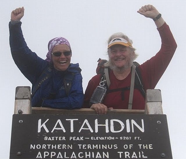
Katahdin

Katahdin
Aug 17 2010 - End of Part 1

Monday, May 31, 2010

31 May - Salisbury CT

Beautiful Memorial Day with a clear, blue sky.  High 88.

Last nights shelter was very nice and had a good spring despite what the Thru-hikers Companion says.  What I forgot to mention was that it was a half mile down hill, some of which was extremely steep.  This partly explains why we were there alone.   Tough way to start the day.

Although it got to 88, it was still in the 70s when we hiked in to Salisbury.   It was a great hike with one nice viewand we passed the giant thumb.  Yesterday we passed an old hang glider launch site that had a great view including Lime Rock Park.  This is classic 1.5 mile car race course used by Paul Newman and other celebrities.  We could hear them racing yesterday and today since it is Memorial Day Weekend.

As we came down the mountain, we could hear drums from the parade.  Coming into town there was a ceremony at the cemetary.  As we passed a church, the folks out front said "Hikers.  Want some lemonade".  We talked about AT hiking, answered the usuaL questions about... How long have we been hiking? Where did you start?  How far are you going?  How much does that pack weigh?  They gave us directions to where we are staying and we headed off.

After we crossed the street and continued, a woman came down from the lawn of a nice house on main street.  She said "your hikers right?  My friend Betty would like to know if you would come up and have some lemonade and talk about your hike."  So we did.  Betty is the owner of the house and having a party for her friends to view the parade.   We had lemonade and donuts, answered questions including "Can I try it on?" which Wendy got after "How much does that pack weigh?"  Keep in mind that we have not been in town to take a shower for 10 days.  Everyone was extremely nice and very proud of their village (which they should be - classic Norman Rockwell as Betty said).  Then the parade came back through town from the cemetary and we got to see it after all - and with a front row seat.  They pointed out Vanessa's house (she rents rooms to hikers) and we said our goodbyes and went to get our room and most importantly, a shower.  What a wonderful introduction to Salisbury!

Obviously, we like Salisbury very much.  We now plan to take a zero day here tomorrow during the storms.
Salisbury, CT

A beautiful, quaint, New England village.

Salisbury on Memorial Day

Northern pine forest

Connecticut view and giant thumb rock

Sunday, May 30, 2010

30 May - Limestone Spring Lean-to.

Mostly clear, high 84. But it was less humid and much cooler in the Green Tunnel.

Good hiking day - fairly easy trail. We did 12.8 miles to Limestone Spring Lean-to. The woods here are very nice - not many vistas but a nice mixture of northern pine forest and deciduous trees.

Saw lots of people out fishing in the Housatonic, floating in kayaks, riding in a Jeep. Saw one nice trout caught.

As we came out of the mountains, we encountered a trail detour. The Rt. 7 Bridge is under construction and only has on lane open and no pedestrian traffic. We were warned of this by False Hope (in the shelter last night. We did not want the detour because there is a restaurant on the other side. While contemplating sneaking across the bridge, a new Toyota Prius stopped across from us. Turned out to be a former thru-hiker, Still Walking. She and her husband were out for a day hike. She knew about the bridge and offered a ride across. This saved us a lot of extra road walking out in the heat. TRAIL MAGIC!

In fact, she took us to the restaurant but it was closed. Imagine our disappointment! She took us back to the near side of the bridge so we only missed a few blazes. We kept walking and ate our Cliff Bars for lunch.

Falls Village was very pretty. The pictures are of the Iron Bridge and the falls just a little way upstream.

On to Salisbury tomorrow.

Still living the dream.

(No signal tonight)

Saturday, May 29, 2010

29 May, Pine Ridge Swamp Lean-to

High 74.  Cloudy and humid with 2 brief showers.   Might rain tonight.

Nice hiking today - Connecticut is very pretty - lots of tall pines.  Many ups and Downs today so 10 miles was more than enough. 

Running out of batteries for the Droid so no pics and only a short journal entry.

Running out of food too.  Should pass a restaurant just off the trail tomorrow.   Then Monday we should arrive in Salisbury and resupply. 

Location Note from #Compass

West Cornwall, CT 06796
USA

Altitude: 1201 ft
Latitude: 41°52'53.0" N
Longitude: 73°23'29.7" W

Friday, May 28, 2010

28 May - Stewart Hollow Lean-to


Hiked 15.7 miles today.  Too many climbs.   Did not arrive until after 8:00. 

Picture is from a brook we crossed.

Friday night of Memorial Day weekend and we have the shelter to ourselves.  A nice surprise.  We are in the Stewart Hollow Lean-to next to the Housatonic River.  We ate, bathed in the river, and are ready for bed.

LOCATION:

Location Note from #Compass

Altitude: 645 ft
Latitude: 41°46'44.3" N
Longitude: 73°25'4.5" W

Thursday, May 27, 2010

27 May - Ten Mile Lean-to, Conn.

Less hot and humid, high in upper 70s.

The trail was nice today too. It needed to be! As nice as yesterday afternoon was (Pete and his people, the shower, the hot dogs across the street), sleeping was terrible. The place was between the train track and the highway. Trains and trucks all night. Very loud! I got less than 2 hours of sleep. Hikers beware.

I mentioned the trail was nice. I have meant to say how nice the trail has been in the 2nd half of NY. No PUDS (Pointless Ups and Downs). The trail has been well designed - to get from point A to point B efficiently - rather than to "show off our rocks".

The big news today is that we are in Connecticut! Maryland, Pennsylvania, New Jersey, and New York are all done (WV done too). The pictures are of Ten Mile River and Lean-to, our first stop in Conn.

Since northern PA, we have seen small patches of northern forest (tall pines, open floor). Coming down Ten Mile Mtn. today we came into such an area. We are seeing it more frequently now. The sun comes up earlier too, before 5:00.

Afraid to use this bridge in high water.

Wednesday, May 26, 2010

26 May Wednesday - near Pawling, NY

Hot and humid, hi 93.

The heat was mitigated temporarily when after 4.5 miles of hiking, we arrived at Nuclear Lake. This area was a nuclear research facility until 1972. It was cleaned up and tested after which the NPS rerouted the trail next to it. Elvis Trailsly told us about it yesterday. It was nice, cold but wonderful on a hot day. One benefit of getting older is you do not have to worry about long term consequences.

The cool did not last however when we resumed. We did pass the Dover Oak. It is reported as the largest oak tree on the AT and is estimated to be more than 300 years old. It is over 20 feet in circumference at 4 feet above ground.

We arrived at NY 22 and saw the AT Train Station. The train from NY actually stops here on weekends.

We are staying at Native Landscapes. Owner Pete Muroski is a hiker and lets thru-hikers camp here. More important, the let us use the shower. Wonderful after a long (11 miles), hot day. Even better, there was a hot dog trailer across the road. Still hiking "deli-to-deli".

Nuclear Lake

Location Note from #Compass

Altitude: 708 ft
Latitude: 41°35'48.8" N
Longitude: 73°38'49.3" W

Tuesday, May 25, 2010

25 May, Morgan Stewart Shelter

Hot and humid.  94 today and too warm last night.

Short day to this shelter, only 9 miles.  Saw one snake.

Highlight of the was Mountain Top Deli.  We heard of this place on the trail days before we got here.  It is 0.3 mi. down the road but well worth it.  We had one sandwich for lunch, and got another (without mayo) for dinner.   We are well fed tonight. 

We are still with Rewind (lunch and dinner).  He will go about 16 miles tomorrow,  we will go about 11.  It has been fun. 

We met Elvis Trailsly today at the deli.  He has been a trail maintainer for 30 years.   He was also featured in the National Geographic show on the Appalachian Trail (the DVD is circulating in the family).  He is the one who spoke about Lymes Disease.

Speaking of which, they no longer warn us about bears but about ticks. 
Picture is from our hike today.

Monday, May 24, 2010

24 May, RPH Shelter

Mostly cloudy all day.  Some sun and a little rain.  High around 80.  Humid.

Nice hiking today; some up and down but not too bad.   Very pretty forest,  tall trees, high canopy and open underneath.  Also grassy open hilltops.  Saw 3 deer, 1 snake,  and 1 otter. 

Met 2 thru-hikers, Full Pint and Karma, who left GA on the 28th of Feb.  They hope to finish by July 1st.  Its kind of disheartening. 

Alps joined tonight by Rewind.  We met him at Fingerboard Shelter.   He took a day off now he has caught up again.  We will probably hike together tomorrow too.

RPH Shelter is a former house purchased by a hiking club.  The had to remove 1 wall and all the electricity to met Nat. Park Service codes for shelters.  But it has a covered porch, open porch,  patio, picnic tables and lawn chairs.  Also has a hand water pump.  It is on a road so we ordered pizza delivered for dinner.  

Sunday, May 23, 2010

23 May Sunday - Dennytown Rd. Campsite

Cloudy and humid.  High in low 70s.  It was "about to rain" all day but it hardly rained at all.  Arrived in camp with it still threatening but got the tent up while it was still realitively dry.  Now it looks like the rain is gone.  My kind of rainy day!

We saw 2 snakes,  2 deer, and lots of chipmunks.  I'm mention chipmunks because we have seen so many this last week.

Met several section hikers today.  One had a Cocker Spaniel smaller than Isis.  He says she always hikes with him (15+ miles a day).  Guess Isis is out of shape. 

Another named the Wandering Astronomer has been hiking many years and was an amateur astronomer.   Met some astronomers while hiking which led to getting a job in astronomy.  A few years later he met his wife while hiking the AT.  The trail has been important in his life.

Saturday, May 22, 2010

22 May - Hemlock Springs Campsite

High inflow 70s.  Humid.

Easy hike today.  We only came a few miles out of Bear Mountain.

We needed to do laundry and get to the Post Office this morning.  We were told that the PO was less than a mile up the road in Ft. Montgomery and the laundry nearby.  We walked and it was more than a mile but was closed - did not open until 9:00.  Worse,  there was no laundry nearby. 

I arranged for a taxi, we got our package,  but the taxi did not arrive for nearly an hour.  We went to a laundromat about 4 miles away.

There were protesters infront of the laundromat, anti-war vs. support our troups.  There was some more extreme rhetoric, for example "I'll burn 10,000 flags if I have to . . .".   Guess they were hoping to catch the eye of the President as he drove by.

Made it back to the hotel without event. Got a late checkout.  Hiked out of town in the afternoon along the lake getting back to the AT and then through Bear Mtn.  zoo to get to the bridge across the Hudson river.  Crossing the Hudson is widely named as the lowest point on the AT.  Actually, it is a low spot in the zoo near the bear cages.  (Finally saw a bear on this trip.)

This whole area is really nice.  I am sure it gets overrun with people,  starting next weekend.

Rain is forecast for tonight, tomorrow and Monday.  Unfortunately this is stretch of trail with no shelters.  Hate tenting in the rain.

I have no map AT map of this area.  When the ATC Store sent me my order they left out 2 maps, one of this area and one in southwest VA.  In both cases they sent 2 copies of an adjacent map.  Thanks.

Friday, May 21, 2010

21 May, Bear Mtn. State Park

Warm night under the stars.  Hot today, 90.

Left the shelter early and hiked 5.4 miles by 10:20.   Only 3 more miles to the shelter we planned to stay in.  Too little?  The trail had been easy and we felt good.  We called and found a room available here in the park at the Overlook Lodge which surprised us because all rooms were reserved for West Point graduation tomorrow.  We decided to reserve it and keep hiking.  Naturally it is very expensive this weekend.

Total hiking was 13.5 miles plus another mile to get here.  We made our decision based on the first 5 miles which were easy. After that,  it was all up and down.  Very tough day - we did not get here until 7:30.

We crossed the Palisades Interstate Parkway - only 34 miles to New York City.  We were literally running across the PIP between cars going 60+ mph.  We had three more opportunities to see NYC skyline.  We could see it at the first viewpoint.   Skipped the second (too far off the trail).  Too much haze to see it from the top of Bear Mtn.

Tomorrow we need to get a food mail drop before noon in Ft. Montgomery and do laundry.  We will probably hike a few miles out of town to a campsite.   Should be crazy around here tomorrow.   President Obama is the speaker.

Thursday, May 20, 2010

20 May Fingerboard Shelter

Warm night and day with high near 80.  Clear blue sky.

Walking along a cliff 60-70 feet high is not a normal way to start the day but that is what we were doing within a few minutes of leaving camp today.  Trail was up and down all day.  We did the Agony Grind (long steep decent ) and the Lemon Squeezer (tight squeeze and very difficult climb), two AT tests that we passed today.  Knee and shin both did well until the end.  It was a tough day but only 8.4 miles.

We are exactly 800 miles from Katahdin.  We have only done 365 miles so far.  I know we are not moving fast enough but after today, I don't think we can go much faster.

Met Cookie Monster a thru-hiker in 1987 who is now section hiking. 

Arrived at Fingerboard Shelter with three other hikers.  Rewind is finishing his AT hike from Duncannon to Katahdin.  One Guy left for next shelter.   The third, Paddy O, was here with "trail magic".  He brought beer, soda, Gatorade,  and cookies.  Later we were joined by L-Ray and Two Cats, section hikers from Ohio.

Fingerboard was built in 1928 and is one of the oldest shelters on the whole trail. 

Sleeping under the stars tonight.  

Wednesday, May 19, 2010

19 May. North of New York City

Rained all night, low in the 40s.  Overcast day with some misting rain.  Clearing in pm.

Apparently we missed the Rhododendron blooming.  Saw plenty on southern PA before blooming.  Now they are past blooming here.  Mtn. Laurel getting ready to bloom.   Also many more Lady Slippers blooming.

Saw 1 snake, 1 deer, and lots of ravens.  There was a nest at the top of some rocks the trail went over.  I got very close to the ravens before they left the nest.  Have nice pictures with the camera but unfortunately not with the droid.

Got to the shelter by noon.  Seems a waste.  Leg feels good....

Kept walking.  Did a total of 10 miles.   Sleeping on Buchanan Mtn. in the tent. 

Passed Fitsgerald Falls (see picture).    Crossed Mombasha High Point.   Even though it was cloudy overhead,  it was clear underneath.  We could see the New York City skyline.   The picture is grainy but trust me, you could see it.

Tuesday, May 18, 2010

17 - 18 May Greenwood Lake, NY

Beautiful hiking day with temps in the low 70s.

Saw one deer and three snakes.  One was probably a rattlesnake but I only saw it briefly before it disappeared under a rock.  We crossed Prospect Rock which is the highest point on the AT in NY.

I had a tough day hiking - some leg pain but I walked slowly and carefully.  It is frustrating knowing we need to do more miles per day.  But at least we are still moving.

Arrived here yesterday afternoon.  Had a great Italian sub at Delicious Deli.  We were also steered to the Linden Motel.  We have a room with a view of the lake - watching it rain now.

Taking another zero day.   Alternating hot and cold on my leg and giving it a rest, hoping it will heal enough so I can walk normally.

Monday, May 17, 2010

Location Note from #Compass

State line.

Hewitt, NJ 07421
USA

Altitude: 1395 ft
Latitude: 41°11'30.2" N
Longitude: 74°20'38.6" W

Sunday, May 16, 2010

16 May (Sunday) Wawayanda Hilton

Beautiful, low 70s.

Bob from Cider Mill B&B (645 258-3044) took us back to the trail this morning. Although expensive (most we have paid this trip), the price included dinner, breakfast, and shuttle from and back to the trail. And the meals were incredible.

Nice trail and only 7.3 miles. The trail started at Pochuck Creek Footbridge, a long series of boardwalks. It then climbed what the locals call "Stairway to Heaven". It is almost 1000 ft. vertical. The picture is a view from the top.

The shin splints did better; some pain but better than yesterday. Plan is to do small miles again tomorrow then take a zero day in Greenwood Lake, NY on Tue. We finish NJ tomorrow!!!

We are staying at the Wawayanda Hilton. This is trail humor for a three sided, six person shelter. We are sharing the shelter with Sampson, who also started in HF. He intends to do a thru-hike too.

By the way, Pochunk is Lenape for "out of the way place". Wawayanda is Lenape for "winding waters".

Saturday, May 15, 2010

More pics from 15 May

15 May. Glenwood, NJ. Cider Mill B&B

Beautiful day low 70s.  Wonderful hiking and mostly easy trail.

While Esther was here, she brought her computer and scale.  First, I was able to update the map through Unionville.  I also confirmed that I am continjuing to lose weight.

Forgot to mention that on Thur.  we saw deer several times and a wild turkey.  Today again we saw deer several times.  We also saw White Swans, 2 snakes, a Great Blue Heron, and a muskrat.

After High Point, we came down down on the trail and have been going through lowlands with lots of swamp.  There were many boardwalks today.  Tomorrow we start with Pochunk boardwalk which is 0.8 mile long.

Arrived at Pochuck Shelter at 1:30.  We had planned a short day but that was before we took a zero day.  I had wanted a motel so I could get ice for my shin.  It really seemed to help yesterday.  The shin hurt today but I had been going easy and wanted to continue.

We hiked 9.5 miles to Glenwood, NJ.  On the way we called Applewood B&B but they were full.  They gave me another place, also full, who gave me the number for Cider Mill B&B.   Bob came to pick us up.  The prepared a wonderful dinner tonight, will give us breakfast tomorrow, and take us back to the trail.  It is very expensive but medically necessary.

The day started very bad.  We were almost in a car crash.  A taxi took us to the trail in Unionville.  The driver pulled out in front of a SUV going 50+ mph.  He had no time to stop.  Wendy made a noise and the taxi driver stopped just as he entered the far lane.  The SUV swerved (mostly too late) and went by.  It was over.  That would have changed everything.

Next place to stay is 18 miles away so we will sleep on the trail tomorrow.  Ice on my shins now.  I am using my hiking poles more like crutches - slow but effective.

Life is tough on the trail.

There were 14 pillows on that bed!

Wallkill River NWR

Near Unionville.

Friday, May 14, 2010

Sandpiper and Aunt Esther

14 May (Friday) Days Inn near Unionville, zero day

Decided to rest my leg for a day and watch the rain out the window. We have had enough rain for now.

Esther took Wendy to the laundromat so we will have clean, dry clothes. We are drying the rest of our gear in the hotel room.

We need to go to the drug store and maybe the food store. We will go to lunch before Esther leaves. It is great having access to a car - so nice of her to come visit us and get us off the trail for a day.

Thursday, May 13, 2010

13 May. Unionville, NY

Very wet and cold this morning again. Low was back in the 30s but it warmed to 50. Saw a wild turkey today and several more deer. Also, saw many more Lady Slippers after the sun rose higher.

The rain stopped but the forest was soaked. The branches were hanging over the trail so as we walked through, we got as wet as if it were raining. I started the day with 2 shirts, fleece sweater, and rain coat plus long underwear, pants and rain pants. And gloves and a hat. By end of day, I was down to just the lightest of the two shirts. Below picture is when the sun came out and the clouds were still low.

We hiked to High Point State Park. Below is a picture of the monument to veterans. It is located at the highest point in New Jersey. From this view point, you are supposed to be able to see New York city on a clear day. It was clear but I could not see it.

After this, the trail turns South East, perpendicular to the direction we want. It is following the state line between New Jersey and New York. Thus, tonight we are actually in New York. But we won't be finished with New Jersey for a couple more days. Actually, this area includes the tri-state area of NJ, NY, and Pennsylvania.

We came down out of the mountains after High Point and walked across low lands, farms and swamps. In one area, we crossed a 0.4 mile boardwalk. It is made of 8x8" beams stacked 4 high in places to support the boardwalk.

In all, we hiked about 14.5 miles today. Wendy's aunt Esther met us in Unionville and took us to a motel. Wonderful! We just got back from dinner. Also wonderful. Not sure about tomorrow. Planned to hike but my leg was bad today and the weather forecast is not good tomorrow.

12 May. Mashipacong Shelter

Cold rain! It rained all night and most of the day. Low was mid 30s to a high of around 40.

Two more hikers arrived at dark. It was starting to rain. One slept at our feet across the bottom of the raised floor. No room for the 7th so they pulled the picnic table up under the roof overhang and he slept on the table. The last 2 boys are brothers. They and the one who arrived earlier are all hiking 25+ miles per day. Probably because of the rain (no one wanted to get out of the sleeping bag) they slept late. We did not get out of the shelter and start hiking until about 10:00.

Hiked all day in the rain. The picture is from our lunch stop at Gren Anderson Shelter. We did a little more than 12 miles. Saw many Lady Slippers and a few orange lizards, all struggling with the cold temps.

Trouble with my left leg today - seems like shin splints. Very painful. Plus the hiking was very unpleasant and the rocks were very slippery. Better to step on grass or leaves than the rocks. Usually it is the reverse. We planned to do 15+ miles today but stopped at Mashipacong doing only 11+.

Again no data connection.

11 May. Brink Rd. Shelter

Coldest night yet, 28.  Partly sunny in am but clouds came bringing rain now (6:30). 

We saw the first deer of the hike (hard to believe).  Klipspringer saw a bear today.  He and Farmer (pronounced Fa-mah in Maine) are in the shelter tonight.   We are all in our bags before 7:00 because it is cold and starting to rain.  New Jersey is known for having an active bear population.

It was cold but OK for hiking.  There were some rocks but also some beautiful sections of trail. 

There has been no data connection all day and problems with the GPS.  I think I got a position registered but I'm not sure.  I will get one and send this tomorrow.

Another hiker just arrived making 5 in here - all this shelter can handle.   He says 3 more are coming.   This is the second batch of thru-hikers who started in GA and are doing big miles. 

Monday, May 10, 2010

10 April Sunday. Zero day (waiting for pack)

My new pack arrived - but not early enough to leave today.  It is a GraniteGear Nimbus Meridian, like the one in the picture, only burnt orange iso blue.  I have almost all of my gear in it.  It feels a 1000% better.  I am very happy with it.  Thanks again to Rich (Rockfish Gap Outfitters in Waynesboro, VA) for advising me to get this pack, adjusting it, and sending it UPS so we could continue our trip.

I think my new shoes are going to be fine.  I have been wearing them and they feel good so far.  I never would have bought GoLite shoes normally but they were my best choice at Edge of the Woods Outfitters here in DWG (and they were on sale).  There was no time to have Rich send another package.

Wendy' hiking poles were also repaired at Edge of the Woods Outfitters.  They will be driving us to the AT in the morning. 

Sunday, May 9, 2010

Wool E. Mammoth and Often Lost

Other pictures from todays hike...

09 May - Sunday - slack pack day back to DWG

Cold day and very windy, 25-30 mph. It was in the 30s all morning with light sleet twice. High maybe 50 at times. It was mostly cloudy until afternoon. When the sun was out and no wind, it was too warm (for how we were dressed). A few minutes later, in the wind and under the clouds, we were cold.

While waiting for my new pack, we accepted Wool E. Mammoth's offer to help us slack pack. He and Often Lost took us to Millbrook Rd. In New Jersey. We hiked 14 miles back to DWG without packs.

Overall it was a beautiful but cold day. Cold is better than warm while your hiking. When you stop, cold is a problem but today, we were back at DWG in the motel so, no problem. There were a few patches of PA style rocks but overall it was much nicer in NJ.

One of the nice things about the trail is the people - all kinds of people. Today while hiking south, we met the following people going north:

Freeman from Maine who we previously met last week. Last year he hiked to Parisburg, VA and spent the winter there. Now he is headed back to Maine.

Tick who is doing a flip flop starting in Harper's Ferry like us. We had heard of him for some time but today is the first time we met him.

We also passed 4 young guys we previously met in town. They are doing a thru-hike GA-ME. They are doing big miles so we are not likely to see them again.

Also saw/met many locals out camping or day hiking. We met a woman previously met last weekend on the other side of Lehigh Gap. This is the second time this has happened.

On the way down to DWG, my shoe blew out. I have never seen such a failure. I duct taped it and made it down. I went to Edge of the Woods outfitter and was able to buy a pair of GoLite shoes that I think will work.


Saturday, May 8, 2010

08 May. DWG (zero day)

Spent the morning preparing a plan for the next few weeks including mail drops and town visits. Also going through my pack to find more I can do without since my new pack is about 12% smaller.

I have arranged for us to get a ride tomorrow and again on Tuesday (Mon. if the pack arrives early) so that we can hike tomorrow. We will spend the night here tomorrow and wait for the pack on Mon.

The Slatington 7:

Boo and Scout (Robert and Debbie) are from Texas; recently hiked in Dominican Rep; in front by a day; getting off trail temporarily later this month. They are doing a flip-flop thru-hike of the AT, similar to us.

Outside Dog (Steve) is a retired lawyer from Minnesota; experienced hiker all around; also temporarily getting off the trail later this summer. He is in his second week of a flip-flop thru hike starting in Port Clinton.

Wool E. Mammoth (Lance) is a nurse from Binghamton, NY (as is Jennifer); section hiking the AT for a couple of years and now less than 90 miles from completion. He will finish next weekend.

Jaybird (Jay) is a network TV audio engineer from Nashville, TN; previously lived in Charlottesville/Waynesboro area in his AM radio days. He fell and injured his leg/ankle and had to slow down his planned hike. This allowed us to meet him. He is section hiking GA-ME since 2002 and has completed 1165 miles (including all of PA!) He has finished this year and we celebrated and said goodbyes last night.

Pics in DWG